Category:West Felton
Jump to navigation
Jump to search
English: West Felton is a civil parish and village in Shropshire, England. The parish includes the hamlets of Sandford, Twyford, Sutton, Grimpo, Haughton, and Rednal.

village and civil parish in Shropshire, England  | |||||
| Upload media | |||||
| Instance of | |||||
|---|---|---|---|---|---|
| Location | Shropshire, West Midlands, England | ||||
 | |||||
Subcategories
This category has the following 4 subcategories, out of 4 total.
Media in category "West Felton"
The following 200 files are in this category, out of 240 total.
(previous page) (next page)-
 2mph speed limit, near Queen's Head - geograph.org.uk - 5183587.jpg 768 × 1,024; 259 KB
-
 A warning at the mooring, near Queen's Head - geograph.org.uk - 5183592.jpg 1,024 × 768; 184 KB
-
 A5 - footbridge at West Felton - geograph.org.uk - 2248665.jpg 640 × 480; 64 KB
-

-
 A5 approaches West Felton Junction - geograph.org.uk - 3711082.jpg 3,648 × 2,736; 1.73 MB
-
 A5 approaching Queen's Head junction - geograph.org.uk - 2248673.jpg 640 × 480; 64 KB
-
 A5 at Fox Lane overbridge - geograph.org.uk - 5249199.jpg 640 × 512; 58 KB
-
 A5 at Long Oak - geograph.org.uk - 2248654.jpg 640 × 480; 62 KB
-
 A5 at Weirbrook House - geograph.org.uk - 5249198.jpg 640 × 480; 46 KB
-
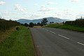
 A5 at West Felton junction - geograph.org.uk - 2248662.jpg 640 × 480; 64 KB
-
 A5 bridge over Montgomery Canal - geograph.org.uk - 2086887.jpg 640 × 480; 65 KB
-
 A5 crosses the Montgomery Canal - geograph.org.uk - 3711087.jpg 3,648 × 2,736; 1.59 MB
-
 A5 footbridge at West Felton - geograph.org.uk - 3711084.jpg 3,648 × 2,736; 2.05 MB
-
 A5 in a cutting - geograph.org.uk - 3138699.jpg 640 × 367; 42 KB
-
 A5 near West Felton - geograph.org.uk - 3138700.jpg 640 × 488; 52 KB
-
 A5 north of Long Oak - geograph.org.uk - 2248657.jpg 640 × 480; 54 KB
-
 A5 south of Queen's Head - geograph.org.uk - 2248671.jpg 640 × 480; 53 KB
-
 A5 south of Queen's Head - geograph.org.uk - 3138698.jpg 640 × 430; 52 KB
-
 A5 south of Queen's Head - geograph.org.uk - 3711086.jpg 3,648 × 2,736; 1.5 MB
-
 A5, Long Oak - geograph.org.uk - 3138713.jpg 640 × 430; 68 KB
-
 A5, old alignments - geograph.org.uk - 6241407.jpg 1,024 × 576; 230 KB
-
 A5, Sandford turning - geograph.org.uk - 3138705.jpg 640 × 430; 76 KB
-
 A5, West Felton turning - geograph.org.uk - 3138703.jpg 640 × 430; 61 KB
-
 Aston Bottom Lock - geograph.org.uk - 1002147.jpg 640 × 428; 126 KB
-
 Aston Bottom Lock - geograph.org.uk - 1002701.jpg 640 × 428; 122 KB
-
 Aston Bottom Lock - geograph.org.uk - 1002707.jpg 640 × 428; 121 KB
-
 Aston Middle Lock - geograph.org.uk - 1002135.jpg 640 × 428; 121 KB
-
 Aston Top Lock - geograph.org.uk - 1002093.jpg 640 × 428; 101 KB
-

-
 B5009 at West Felton - geograph.org.uk - 312001.jpg 640 × 480; 81 KB
-
 B5009 south of West Felton - geograph.org.uk - 3540570.jpg 640 × 453; 86 KB
-
 Barn at Sandford - geograph.org.uk - 5999663.jpg 5,184 × 3,888; 4.14 MB
-
 Barn, Queens Park - geograph.org.uk - 4463050.jpg 640 × 426; 38 KB
-
 Barns, Lane End House - geograph.org.uk - 4467653.jpg 640 × 359; 35 KB
-
 Bend at New House - geograph.org.uk - 3568420.jpg 640 × 427; 66 KB
-
 Blind Summit, A5 - geograph.org.uk - 3138711.jpg 640 × 339; 52 KB
-
 Bridge 76 on Montgomery Canal - geograph.org.uk - 2086868.jpg 640 × 480; 117 KB
-
-
 Built for speed - geograph.org.uk - 5112608.jpg 1,600 × 1,067; 404 KB
-
 Canal at Heath Houses - geograph.org.uk - 6317677.jpg 4,896 × 3,264; 6.69 MB
-
 Canal Boat at Queen's Head - geograph.org.uk - 2086872.jpg 640 × 480; 76 KB
-
 Canal boat at Queen's Head Wharf - geograph.org.uk - 2086881.jpg 640 × 480; 72 KB
-
 Canal Boat turning area - geograph.org.uk - 2086877.jpg 640 × 480; 82 KB
-
 Canal bridge at Queen's Head - geograph.org.uk - 6320448.jpg 4,896 × 3,264; 6.53 MB
-
 Chapel on a sharp bend - geograph.org.uk - 1442475.jpg 640 × 426; 290 KB
-
 Corbett's Bridge - geograph.org.uk - 5849669.jpg 5,184 × 3,888; 5.84 MB
-
 Corbett's Bridge - geograph.org.uk - 599592.jpg 640 × 480; 84 KB
-
 Corbetts Bridge No. 75 on the Montgomery Canal - geograph.org.uk - 4952019.jpg 3,264 × 2,448; 3.72 MB
-
-
 Cross at St Chad's - geograph.org.uk - 2086970.jpg 480 × 640; 83 KB
-
 Cross roads west of Osbaston - geograph.org.uk - 3232631.jpg 640 × 456; 43 KB
-
 Disused buildings - geograph.org.uk - 4467672.jpg 640 × 351; 27 KB
-
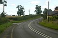
 Early evening on the Knockin road - geograph.org.uk - 1442169.jpg 640 × 426; 260 KB
-
 Enclosed lane from Weirbrook to Sandford - geograph.org.uk - 5230263.jpg 4,000 × 3,000; 2.98 MB
-

-
 Entrance to Rednal Basin - geograph.org.uk - 4993341.jpg 4,608 × 3,456; 5.77 MB
-
 Entrance to Rednal Basin, from the north-east - geograph.org.uk - 5183151.jpg 1,024 × 768; 189 KB
-
 Entrance to Rednal Basin, from the south-east - geograph.org.uk - 5183148.jpg 1,024 × 768; 215 KB
-
 Farmland near Queen's Park - geograph.org.uk - 4463049.jpg 640 × 426; 40 KB
-

-
 Farmland, Tedsmore - geograph.org.uk - 6241366.jpg 1,024 × 683; 254 KB
-
 Field - wood boundary north of Knockin - geograph.org.uk - 5999661.jpg 5,184 × 3,888; 5.41 MB
-
 Field edge view at Bryn-Y-Wystyn Triangulation Pillar - geograph.org.uk - 5230268.jpg 4,000 × 3,000; 2.94 MB
-
 Field entrances on Woolston Road - geograph.org.uk - 3568422.jpg 640 × 418; 103 KB
-
 Field of maize at Ivy Farm - geograph.org.uk - 5849711.jpg 5,184 × 3,888; 3.08 MB
-
 Footbridge over the A5, West Felton - geograph.org.uk - 3138702.jpg 640 × 430; 48 KB
-
 Forage maize, Tedsmore - geograph.org.uk - 6241385.jpg 1,024 × 684; 340 KB
-
 Green and gold - geograph.org.uk - 5849681.jpg 5,184 × 3,888; 3.43 MB
-
 Grimpo Junction - geograph.org.uk - 2086986.jpg 480 × 640; 76 KB
-
 Hardstanding, RAF Rednal - geograph.org.uk - 5959231.jpg 1,024 × 683; 356 KB
-
 Hardstanding, RAF Rednal - geograph.org.uk - 5959244.jpg 1,024 × 683; 426 KB
-
 Harp Farm near Grimpo - geograph.org.uk - 2727988.jpg 640 × 480; 73 KB
-
 Harp Farmhouse near Grimpo - geograph.org.uk - 2727978.jpg 640 × 480; 61 KB
-
 Henbarns - geograph.org.uk - 4467629.jpg 640 × 327; 31 KB
-
 Henbarns Farm - geograph.org.uk - 6288588.jpg 800 × 600; 121 KB
-
 Hill top view from Sutton Triangulation Pillar - geograph.org.uk - 5231443.jpg 4,000 × 3,000; 2.59 MB
-
 Hollyhead Road, West Felton - geograph.org.uk - 5959218.jpg 1,024 × 1,024; 505 KB
-
 Holyhead 93 - geograph.org.uk - 4776173.jpg 1,024 × 768; 291 KB
-
 Holyhead 94 - geograph.org.uk - 4776167.jpg 1,024 × 768; 317 KB
-
 Holyhead 95 - geograph.org.uk - 5185161.jpg 1,024 × 768; 312 KB
-
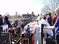
 John Craven opens the restored canal - geograph.org.uk - 260307.jpg 640 × 480; 73 KB
-
 Karting track, Rednal Airfield - geograph.org.uk - 4467668.jpg 640 × 426; 47 KB
-
 KX100 Telephone Box and Telephone Exchange, Queen's Head - geograph.org.uk - 5957449.jpg 2,592 × 1,944; 1.3 MB
-
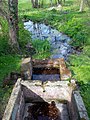
 Landmark at St Winifred's Well - geograph.org.uk - 2934567.jpg 2,592 × 1,944; 1.18 MB
-
 Lane near Osbaston - geograph.org.uk - 312225.jpg 640 × 480; 86 KB
-
 Line of trees - geograph.org.uk - 4467658.jpg 640 × 349; 46 KB
-
 Long Straight on Rednal Airfield - geograph.org.uk - 2086950.jpg 640 × 480; 57 KB
-
 Long Wood, Tedsmore - geograph.org.uk - 6241371.jpg 1,024 × 683; 424 KB
-
 Looking back to Woolston - geograph.org.uk - 1827299.jpg 640 × 480; 49 KB
-
 Maize, Ivy Farm - geograph.org.uk - 5959219.jpg 1,024 × 683; 339 KB
-
 Milepost on Montgomery Canal - geograph.org.uk - 2086874.jpg 640 × 480; 104 KB
-
 Milestone near Long Oak.jpg 480 × 640; 163 KB
-
 Milestone near Queen's Head.jpg 768 × 1,024; 299 KB
-
 Milestone south of West Felton.jpg 768 × 1,024; 277 KB
-
 Montgomery Canal - 'Saturn' at Rednal Warehouse - geograph.org.uk - 5112589.jpg 1,600 × 1,064; 520 KB
-
 Montgomery Canal - A5 Bypass Bridge No76A - geograph.org.uk - 5113282.jpg 1,600 × 1,064; 430 KB
-
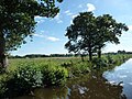
 Montgomery Canal - geograph.org.uk - 4945792.jpg 3,264 × 2,448; 3.68 MB
-
 Montgomery Canal - geograph.org.uk - 4951970.jpg 3,264 × 2,448; 3.65 MB
-
 Montgomery Canal - geograph.org.uk - 599590.jpg 480 × 640; 56 KB
-
 Montgomery Canal - geograph.org.uk - 599597.jpg 480 × 640; 70 KB
-
 Montgomery Canal - Queen's Head - Bridge No76 - geograph.org.uk - 5113293.jpg 1,600 × 1,064; 480 KB
-
 Montgomery Canal - Rednal Canal Warehouse - geograph.org.uk - 5112526.jpg 1,600 × 984; 473 KB
-
 Montgomery Canal - view south from Bridge No75 - geograph.org.uk - 5113270.jpg 1,600 × 1,064; 445 KB
-
 Montgomery Canal 3 mile milepost - geograph.org.uk - 580240.jpg 640 × 480; 109 KB
-
 Montgomery Canal 4 mile milepost - geograph.org.uk - 580176.jpg 640 × 480; 98 KB
-
 Montgomery Canal 5 mile milepost - geograph.org.uk - 580320.jpg 640 × 480; 99 KB
-
 Montgomery canal at Queen's Head - geograph.org.uk - 52452.jpg 640 × 480; 123 KB
-
 Montgomery Canal at Queens Head - geograph.org.uk - 4951998.jpg 3,264 × 2,448; 3.63 MB
-
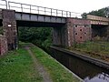
 Montgomery Canal at railway bridge - geograph.org.uk - 2154329.jpg 640 × 480; 85 KB
-

-

-
 Montgomery Canal from Queen's Head - geograph.org.uk - 2086865.jpg 640 × 480; 97 KB
-
 Montgomery Canal just north of Rednal - geograph.org.uk - 46858.jpg 640 × 480; 121 KB
-

-
 Montgomery Canal looking south - geograph.org.uk - 2154331.jpg 640 × 480; 113 KB
-
 Montgomery Canal near Queen's Head - geograph.org.uk - 2486960.jpg 573 × 640; 261 KB
-
 Montgomery canal near Rednal - geograph.org.uk - 4952044.jpg 3,264 × 2,448; 3.67 MB
-
 Montgomery Canal near Rednal - geograph.org.uk - 4952055.jpg 3,264 × 2,448; 3.64 MB
-
 Montgomery Canal opposite woodland - geograph.org.uk - 2154314.jpg 640 × 480; 85 KB
-
 Montgomery Canal reed bed - geograph.org.uk - 628470.jpg 640 × 480; 104 KB
-
 Montgomery Canal, Aston bottom lock - geograph.org.uk - 159572.jpg 640 × 480; 123 KB
-

-
 Montgomery Canal, Aston Top Lock - geograph.org.uk - 208174.jpg 640 × 480; 89 KB
-

-
 Montgomery Canal, Heath Houses - geograph.org.uk - 5870789.jpg 1,280 × 851; 437 KB
-
 Montgomery Canal, Queen's Head - geograph.org.uk - 5870770.jpg 1,280 × 851; 437 KB
-
 Montgomery Canal, Queen's Head - geograph.org.uk - 5884170.jpg 1,024 × 576; 235 KB
-
 New House on Woolston Road - geograph.org.uk - 3568419.jpg 640 × 521; 71 KB
-

-
 Old Milestone - geograph.org.uk - 5185157.jpg 768 × 1,024; 351 KB
-
 Once the A5 - geograph.org.uk - 6241411.jpg 1,024 × 576; 210 KB
-
-
 Opening ceremony at Aston Top Lock - geograph.org.uk - 260310.jpg 640 × 480; 89 KB
-
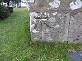 Ordnance Survey Cut Mark - geograph.org.uk - 5234236.jpg 4,000 × 3,000; 4.18 MB
-
 Outside Church Bell at St Chad's - geograph.org.uk - 2086967.jpg 480 × 640; 54 KB
-
 Paintballing area at Rednal Airfield - geograph.org.uk - 2086947.jpg 640 × 480; 72 KB
-
 Parkland at Tedsmore Hall - geograph.org.uk - 647750.jpg 640 × 480; 101 KB
-
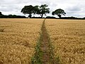 Path through field of barley - geograph.org.uk - 5849703.jpg 5,184 × 3,888; 4.03 MB
-
 Potato field, Haughton - geograph.org.uk - 5959225.jpg 1,024 × 683; 483 KB
-
 Potatoes and irrigation - geograph.org.uk - 5959222.jpg 1,024 × 683; 306 KB
-
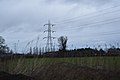 Pylon - geograph.org.uk - 4467619.jpg 640 × 426; 38 KB
-
 Queen's Head - geograph.org.uk - 5849660.jpg 5,184 × 3,888; 3.48 MB
-
 Queen's Head Telephone Exchange - geograph.org.uk - 5957441.jpg 2,592 × 1,944; 1.48 MB
-
 Queen's Head, Bridge 76 over the Montgomery Canal - geograph.org.uk - 6160165.jpg 5,756 × 3,837; 6.83 MB
-
 Queen's Head, The A5 bridge (76a) over the Montgomery Canal - geograph.org.uk - 6160163.jpg 5,584 × 3,722; 6.89 MB
-
 Queens Head from Picnic area - geograph.org.uk - 2086862.jpg 640 × 480; 66 KB
-

-
 Railway bridge at Heath Houses - geograph.org.uk - 5182168.jpg 1,024 × 768; 162 KB
-
 Railway bridge at Heath Houses - geograph.org.uk - 6317685.jpg 4,896 × 3,264; 4.17 MB
-
 Railway bridge on Rednal road - geograph.org.uk - 2154323.jpg 640 × 480; 85 KB
-
 Railway Line - geograph.org.uk - 2294364.jpg 2,448 × 3,264; 1.66 MB
-
-

-
 Raptor in a dead tree, near Penyrestyn - geograph.org.uk - 5183157.jpg 1,024 × 768; 130 KB
-
 Rednal "roving" bridge - geograph.org.uk - 4952065.jpg 3,264 × 2,448; 3.76 MB
-
 Rednal Basin on the Montgomery Canal - geograph.org.uk - 4639482.jpg 3,264 × 2,448; 3.6 MB
-
 Rednal Industrial Estate - geograph.org.uk - 1442611.jpg 640 × 426; 289 KB
-
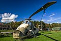 Rednal Industrial Estate helicopter (1) - geograph.org.uk - 5561026.jpg 640 × 427; 347 KB
-
 Rednal Industrial Estate helicopter (2) - geograph.org.uk - 5561028.jpg 640 × 427; 435 KB
-

-
 Rednal Karting - geograph.org.uk - 5959249.jpg 1,024 × 683; 285 KB
-
 Rednal Railway Bridge over the Montgomery Canal - geograph.org.uk - 4639431.jpg 3,264 × 2,448; 2.96 MB
-
 Reflections - geograph.org.uk - 5849667.jpg 3,888 × 5,184; 5.88 MB
-
 Road from Grimpo to Rednal - geograph.org.uk - 5231445.jpg 4,000 × 3,000; 2.63 MB
-
 Road into Queen's Head from Rednal - geograph.org.uk - 2086883.jpg 640 × 480; 66 KB
-
 Road junction at Grimpo - geograph.org.uk - 2086996.jpg 640 × 480; 92 KB
-
 Road junction at Haughton - geograph.org.uk - 2086952.jpg 640 × 480; 74 KB
-
 Road junction at Rednal - geograph.org.uk - 2086922.jpg 640 × 480; 62 KB
-
 Road junction at Sandford - geograph.org.uk - 2154338.jpg 640 × 480; 88 KB
-

-
 Road junction for Aston Moor - geograph.org.uk - 3568435.jpg 640 × 423; 90 KB
-
 Road signs at Rednal, Shropshire, England.jpg 640 × 426; 383 KB
-
 Road to Rednal - geograph.org.uk - 2154319.jpg 640 × 480; 90 KB
-
 Sheep grazing - geograph.org.uk - 4467681.jpg 640 × 426; 53 KB
-
 Sign at road junction in Grimpo - geograph.org.uk - 5849695.jpg 3,648 × 2,736; 2.63 MB
-
 Someone needs schooling^ - geograph.org.uk - 2087012.jpg 640 × 492; 79 KB
-
 St Chad's, Haughton - geograph.org.uk - 5849684.jpg 5,184 × 3,888; 3.87 MB
-
 Summit, Tedsmore - geograph.org.uk - 6241377.jpg 1,024 × 683; 380 KB
-
 Sutton Trig Point - geograph.org.uk - 5849678.jpg 5,184 × 3,888; 4.87 MB
-
 Tedsmore Road - geograph.org.uk - 5822443.jpg 1,024 × 760; 183 KB
-
 Tedsmore Road at Wheatlands - geograph.org.uk - 5822445.jpg 1,024 × 739; 133 KB
-
 The Avenue overbridge, A5 - geograph.org.uk - 3138701.jpg 640 × 430; 50 KB
-
 The Baths at St. Winifred's Well - geograph.org.uk - 2945521.jpg 2,736 × 3,648; 2.55 MB
-
 The Montgomery Canal, north of Rednal Basin - geograph.org.uk - 5182158.jpg 1,024 × 768; 124 KB
-
 The old A5 at Queen's Head - geograph.org.uk - 1442426.jpg 640 × 426; 306 KB
-
 The Queen's Head, near Oswestry - geograph.org.uk - 5929918.jpg 4,896 × 3,672; 6.85 MB
-
 The Queen's Head, Queen's Head - geograph.org.uk - 5870719.jpg 1,280 × 851; 365 KB
-
 The Red House - geograph.org.uk - 1442270.jpg 640 × 426; 284 KB
-
 The road to Knockin - geograph.org.uk - 1442248.jpg 640 × 426; 267 KB
-

-
 To Shrewsbury and beyond - geograph.org.uk - 1442542.jpg 640 × 426; 332 KB
-
 Trees along the Montgomery Canal - geograph.org.uk - 5182152.jpg 1,024 × 768; 170 KB
-
 Unusual grave at St Chad's - geograph.org.uk - 2086962.jpg 480 × 640; 123 KB
-
 View from Haughton railway bridge - geograph.org.uk - 5849689.jpg 5,184 × 3,888; 5.67 MB
-
 View from the cockpit - geograph.org.uk - 6317668.jpg 4,896 × 3,264; 5.9 MB
-
 Warehouse, Montgomery Canal.jpg 1,600 × 1,064; 424 KB
-
 Weirbrook United Reformed Church - geograph.org.uk - 5230262.jpg 4,000 × 3,000; 3.02 MB
-
 West Felton CE Primary School - geograph.org.uk - 5849707.jpg 5,184 × 3,888; 3.74 MB
-
 West Felton Post Office - geograph.org.uk - 188812.jpg 640 × 480; 84 KB
-
 West Felton Primary School - geograph.org.uk - 1442417.jpg 640 × 426; 299 KB


_Lock_-_geograph.org.uk_-_159577.jpg)


_over_the_Montgomery_Canal_-_geograph.org.uk_-_6160163.jpg)


_-_geograph.org.uk_-_5561026.jpg)
_-_geograph.org.uk_-_5561028.jpg)


